

Windermere Walks – Walks alongside or close to Lake Windermere
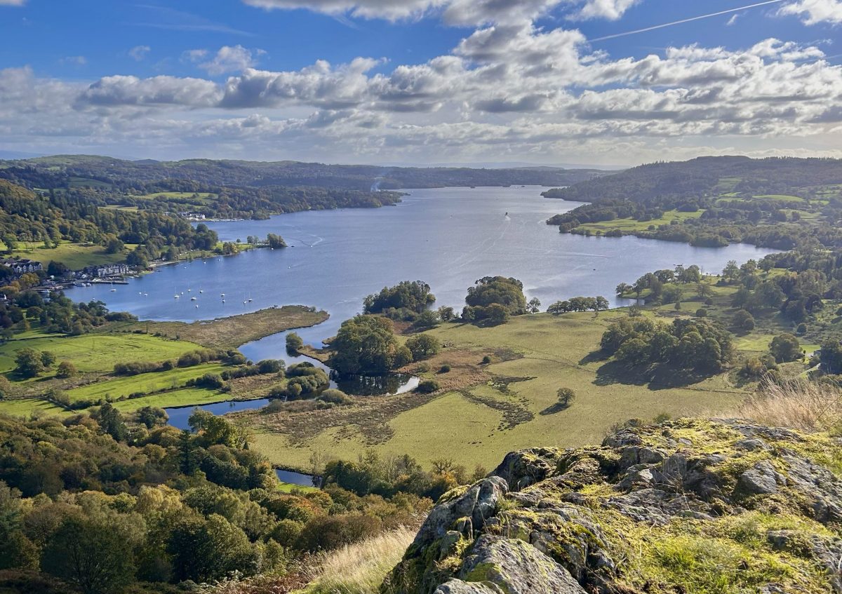
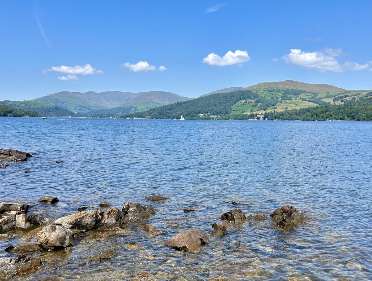
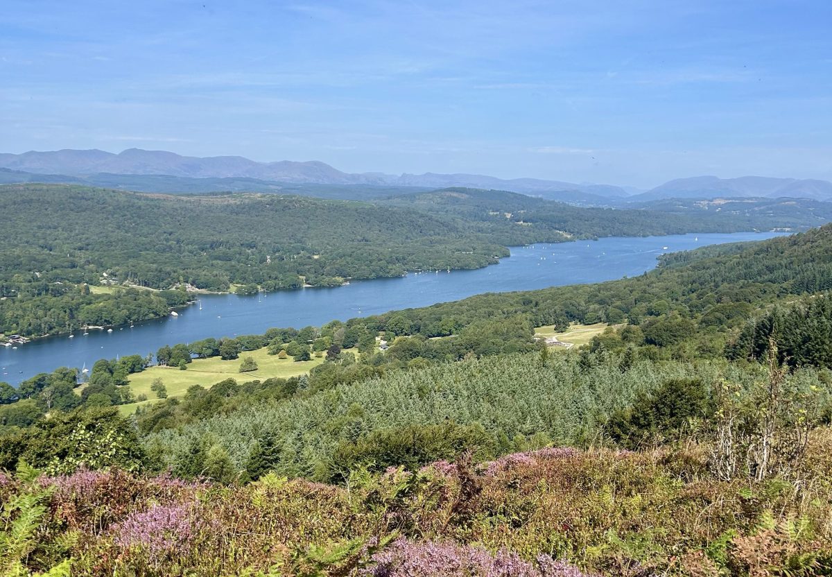
Windermere is the largest, and most well know of all the Lake District main bodies of water. It also boasts some of the most picturesque scenery the Lakes has to offer.
We collected some of our favourite high and low level walks close to Windermere. Whether you’re in the mood for a meandering lakeside stroll or a more energetic hill hike, there are beautiful Windermere walks to match all moods, abilities and weather conditions.
- Claife Heights via Claife Viewing Station – Windermere West Shore. 5.7 miles, 3 hours
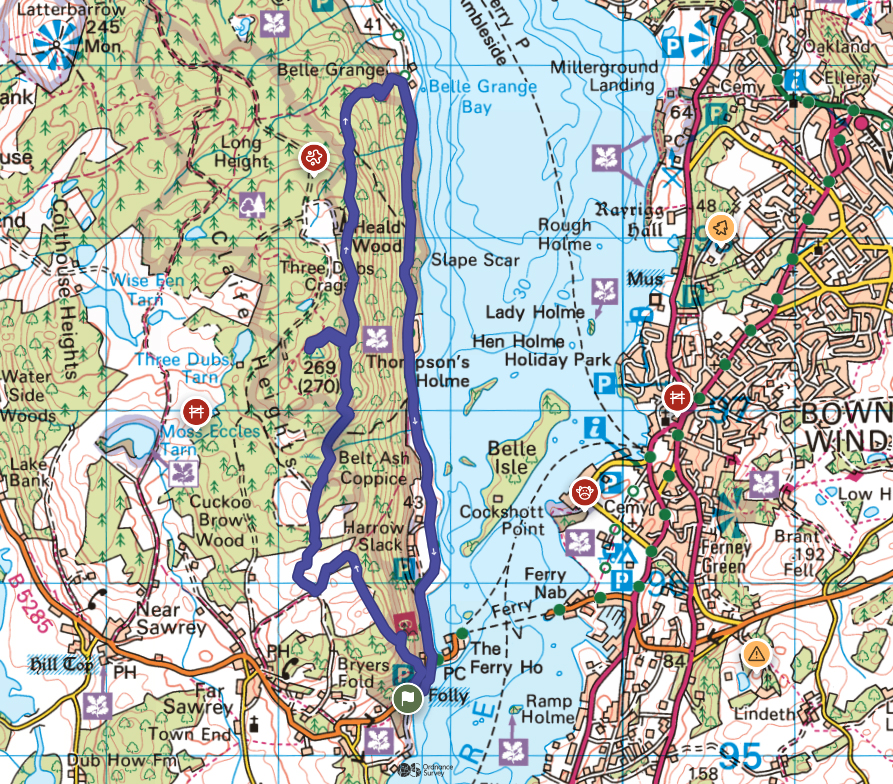
The walk beings at Ash Landing Car Park, close to the ferry terminal on the west side of Windermere.
This walk along the western shore of Windermere incorporates a visit to Claife Viewing Station. Now a ruin, this castle-like structure was built in the 1790s and originally featured different coloured glass in its various windows overlooking the lake. The coloured glass was designed to offer the viewer a glimpse of the lake in each of the different seasons – yellow for summer, orange for autumn, blue for winter and green for spring. Today coloured glass panels around the window openings recreate this concept for modern visitors.
The walk starts at Ash Landing. There is a National Trust car park or, if you’re staying on the eastern side of the lake, you can hop on the ferry across the lake from Bowness then follow the road south to Ash Landing for 0.4 miles.
Take the footpath towards the back of Ashlanding car park signposted to Claife Viewing station. Follow the path as it climbs the stone steps before soon emerging at the ruins.
From the viewing station, leave on the footpath heading uphill and north. The path zig zags through dense woodland before emerging in a clearing with a fallen tree. Continue north on the footpath with open fellside behind a fence on your left and woodland and the lake below on your right. When you reach a walled lane, turn left then, when the lane intersects with another, turn right to continue north. Ignore a track branching off on your left with a gate and continue ahead along the lane.
The path veers left and begins to climb again. Upon emerging from the woods onto open fellside, the summit of Claire Heights appears as a rocky outcrop with flattish top on your left. A minor path diverts to the summit of Claife Heights (an outlying Wainwright). For those wishing to make the minor diversion, far reaching views of Windermere from the summit marked by a trig point are the reward.
Retrace your steps back to the main path. The path continues north but begins to descend. Eventually the footpath intersections with another running west to east. Turn right to follow this wider, stone path down to the lake shore. When you reach a house on your left, the path joins the Wray Castle lakeshore route. Turn right to follow the path with the lakeshore on your left, all the way back to Ash Landing Car Park.
2. Gummer’s How – a small summit at the south-east corner of Windermere with outstanding views. 2 miles,1.5 hours
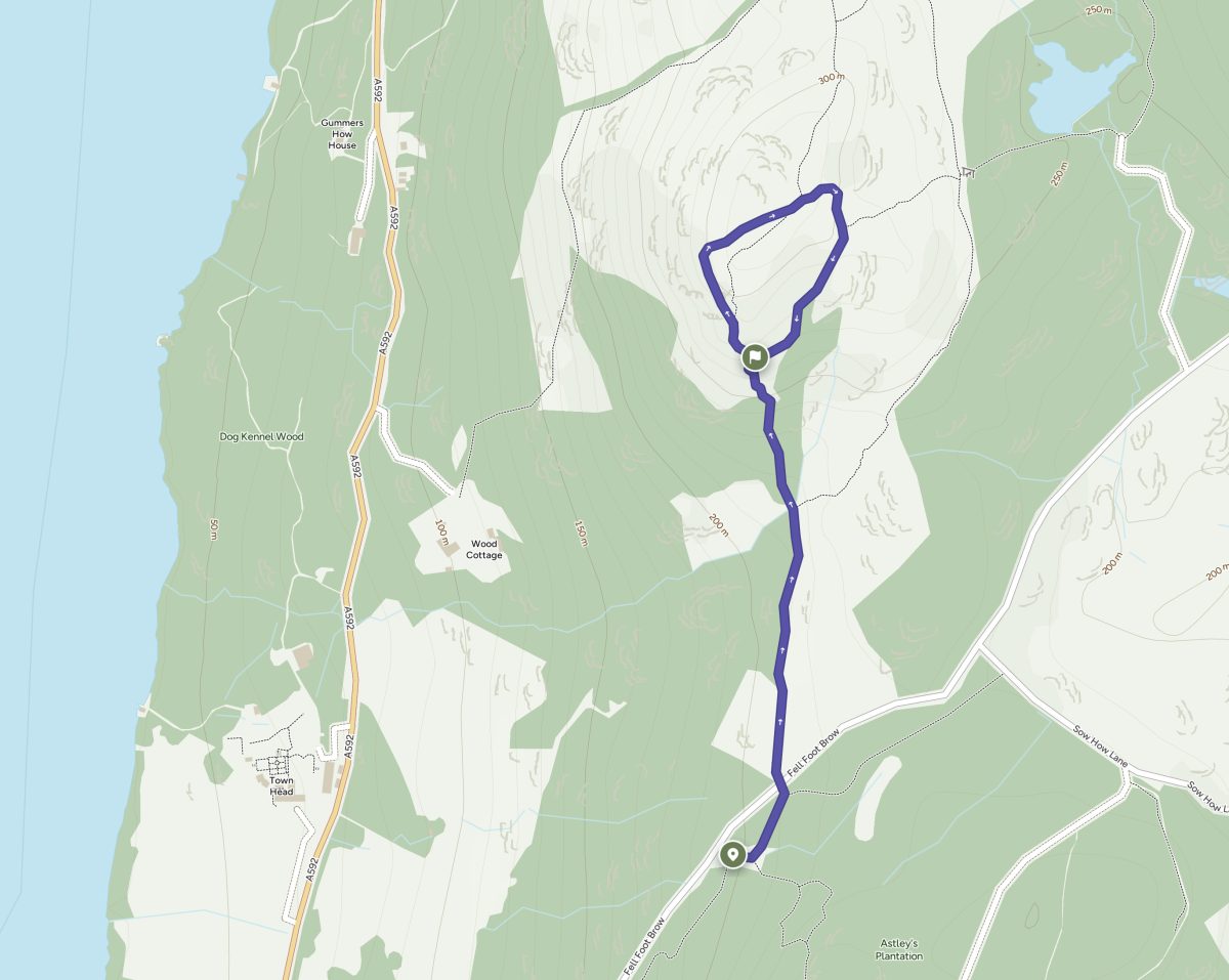
Gummer’s How is a short but in places steep walk with incredible views for your trouble.
The walk starts at Gummer’s How Car park on Fell Foot Brow off the A592 Newby Bridge to Bowness road.
From the car park, take the footpath on the left near the rear of the parking and follow it until it reaches back to the road. Cross the road and go through the gate.
Initially level, and often accompanied by resident cattle, the path soon becomes a stone pitched climb towards the summit. At the end of the pitched path you have a choice – turn right for a more gradual ascent which loops around the back of the summit, or continue ahead for a steeper climb / scramble up the rocky path straight ahead. Both lead to the top of Gummer’s How, marked by a trig point. Our map shows ascent via the steeper route approaching the summit from the west and descent via route leaving the summit in an easterly direction, but you can choose your own route. However you ascend/descend, we do recommend heading away from the summit towards the west to enjoy the best views down the length of Windemere and to the magnificent fells beyond.
3. Newby Bridge to Lakeside – Woodland and lakeshore walk at Windermere’s southwest shore. 2 miles, 1 hour
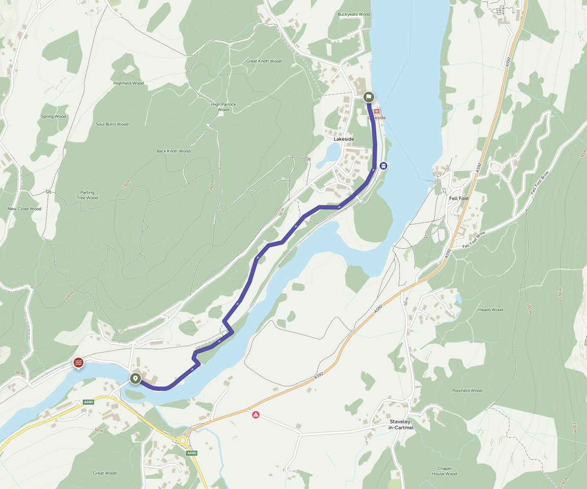
This short, accessible walk is perfect for those using public transport, starting near The Swan in Newby Bridge at Windermere’s southerly tip and ending at Lakeside around 1 mile away, where there is a hotel, café, an aquarium, a steam train station and lake cruises. It then returns by the same footpath making it only 2 miles long with but plenty to see and do at the midway-point.
From The Swan Hotel bus stop at Newby Bridge, cross the bridge then turn right. Head through the Swan car park and pick up the footpath which follows the river on your right.
Cross the accessible footbridge across the heritage railway line and continue with the River Leven on your right.
At a T junction in the path, take the path of the right which follows the railway line to the station, then ferry terminal at Lakeside.
Return via same route.
For those arriving by car, this walk can also be done in reverse by utilising the pay and display car park at Lakeside
4. Loughrigg via Todd Crag from Ambleside – 6.5miles, 3.5hrs
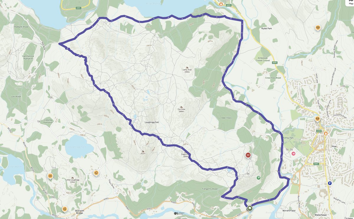
This walk at the northernmost tip of Windermere includes a spectacular vista down to the lake from Todd Cragg. From there, there’s the option to continue on to Loughrigg Fell before returning back to Ambleside for refreshments.
This walk starts at on the A593 at Clappersgate near Ambleside.
Just before the junction to the B5286 a finger post points to a footpath to Loughrigg Fell.
The path begins climbing straight away. Initially between 2 drystone walls, the path sweeps to the left then passes through a gate. Continue ahead with occasional glimpses of Windermere to your left. Upon reaching a small gate, do not go through the gate, instead follow the path which switches back just above the one you’ve been following. Before long you’ ll emerge on the fell plateaux. Various rocky outcrops provide stunning views down to the head of Lake Windermere and east down to Ambleside so it’s worth spending some time exploring and capturing some photos from this beautiful viewpoint.
There are various footpaths criss-crossing on the fell – you’re aiming for a small tarn northwards.
At the tarn, continue ahead in a west then north-west direction. Go through a small gate and continue ahead. The path splits in two. The left fork skirts around the base of Todd Cragg, the right fork leads to the summit so turn right.
From the summit, continue north towards Loughrigg. You’ll soon intersect with the Westmorland Way, a well-used footpath, stone-pitched in places. Turn right to follow the Westmorland Way east all the way to Under Loughrigg.
At the road then turn right again to follow Under Loughrigg back to the A593. At the A593 cross the road to take the paved footpath away from, but parallel to the road. This will lead you back to your starting point.
5. Brant Fell from Bowness – 1.5 miles 1 hour
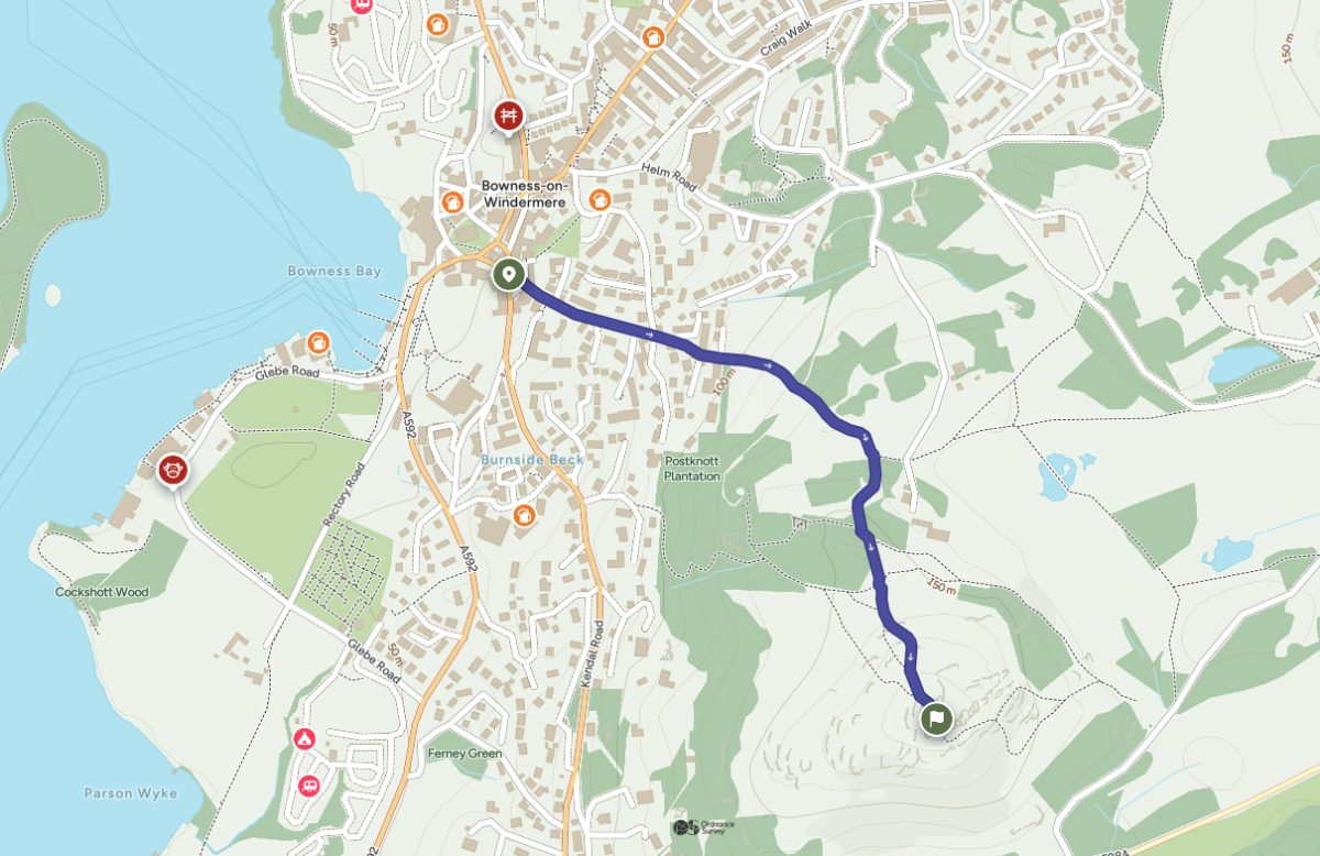
This walk starts in the centre of Bowness and is perfect for those staying in the village or those who are visiting for the day via the Windermere Lake Cruises and seeking a respite from the hustle and bustle of the town centre.
From the centre of Bowness, head up Brantfell Road, which can be reached from the Village Inn Pub. The road heads steeply uphill with houses on either side. The road ends abruptly at a gate leading to a path continuing up hill.
Cross the field, past the end of the Dales Way marker and through another gate.
Turn right along the fenced track signposted to Post Knott. Follow the path as it bears left through woodland and keeping left climb up to the slate bench on Post Knott with beautiful views down to the lake.
At the bench turn left and after around 50m go through the gate to the right, then bear slightly left on the grassy path to go through another gate next to the Brant Fell signpost.
Follow the path that weaves its way between the rocky outcrops climbing the grass bank. Brant Fell summit is topped by two stone pillars of an old gateway.
There are breath-taking views in all directions, but most notably of beautiful Windermere.
Return via same route.
From the junction
6. Staveley Fell and Simpson Ground Reservoir – 4.5 miles, 2 hours 15 minutes
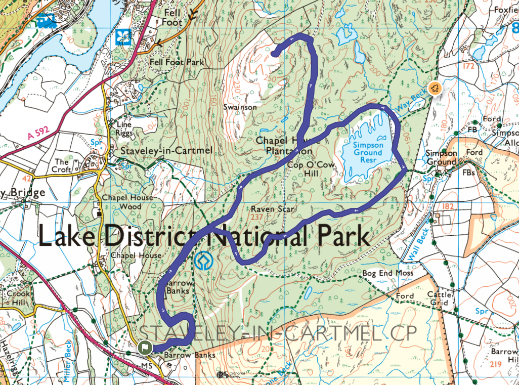
This walk is a much quieter, and slightly longer alternative to Gummer’s How, being on the neighbouring, far less frequented fell, via forest tracks and footpaths.
The walks begins at the Chapel House Forestry Commission Car park near Staveley-in-Cartmel at the very southern end of Windermere.
From the car park, follow the forest track as it winds up the hillside. After the path levels, look out for a minor footpath leaving on the left-hand side, just before a rock face covered in heather.
Following the footpath for approximately 5 minutes leads to the summit of Staveley Fell with wonderful, far-reaching views of Windermere and down to Lakeside. Leave via same footpath and rejoin the mountain road. Turn right to retrace your steps but this time, look out for footpath on your left leading to Simpson Ground Reservoir. This path loops the reservoir, giving you lovely views, particularly from the dam.
After the dam, ignore the path which branches off on the left and continue with the reservoir on your right. The path leads south westerly through the forest. You emerge on another mountain track. Turn left to head downhill then take the footpath signposted on your right into the forest. Follow this path until you emerge on the track you took on your approach. Turn left to follow the mountain road back to the parking area.


